Demand assessment
Profile households by density, income, dwelling type and affordability indicators. Assess addressable demand for fibre to homes, businesses and sites, and identify areas with stronger expansion potential.
Infrastructure planning
Assess where connectivity infrastructure can serve demand, where competitors are present and which areas merit further investment analysis.
Discuss the serviceIntegrate network, demographic and enterprise information in a single GIS database for fibre, wireless and long-term connectivity planning.
Service capabilities
Compare locations and routes using a common spatial framework.
Profile households by density, income, dwelling type and affordability indicators. Assess addressable demand for fibre to homes, businesses and sites, and identify areas with stronger expansion potential.
Map available fibre footprints, tower locations and wireless infrastructure. Examine coverage overlap, underserved areas, proximity to existing assets and substitution from other access technologies.
Compare routes using demand, competitive intensity and infrastructure readiness. Use relative opportunity and risk assessments to inform deployment sequencing, partnerships and investment scenarios.
Integrated evidence
Applications
Identify greenfield opportunities relative to existing fibre footprints. Assess network concentration, competitor overlap and opportunities adjacent to service boundaries to support expansion planning.
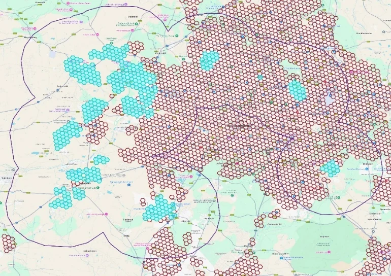
Assess population density and household ICT expenditure potential around proposed access nodes. Prioritise coverage areas for further commercial and network planning.
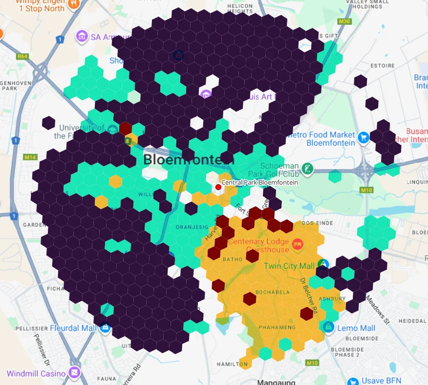
Use modelled household counts, ICT spending potential and settlement density to assess local market opportunities and competitive threats.
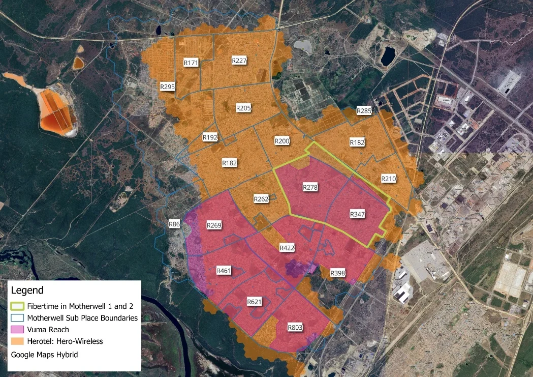
The presentation illustrates configurable spatial assessments, including a 10 km buffer around fibre coverage and a 5 km radius around wireless access nodes. These are use-case examples, rather than fixed service parameters.
Delivery and updates
The service provides detailed GIS datasets and Excel analytical work packages to support expansion, competitive assessment and infrastructure prioritisation. Geographic scope and delivery requirements are agreed for each engagement.
The 2026 service schedule identifies March, June, September and December review windows. Actual data currency depends on source availability.
Scope and governance
The service supports strategic and economic planning. Detailed engineering design, construction approval specifications and bills of materials require separate work.
Results depend on the availability, resolution and accuracy of source data. Network maps, demographic estimates and points of interest can serve as proxies and may exclude unpublished developments. Commercial demand and uptake assessments use models and scenarios.
Outputs do not guarantee commercial viability, regulatory approval, funding or investment outcomes. The service framework includes confidentiality and access controls, data validation, documented assumptions and version control.
Contact Africa Analysis
Tell us which markets, routes or network footprints you want to assess and the investment decisions the analysis needs to support.
Managing Director
Africa Analysis Team (Pty) Ltd